Why Python?
Its a great language! But its not the only language. Just as English, Cantonese, or Punjabi could all be used to explain systemic racism; Python, Javascirpt, or R can all be used to quantify and visualize the scale of the problem. like python because its very flexible, fairly easy to read / write, well suited for data analysis, has lots of packages for GIS, and it’s completely free!
Packages
Python has a number of built in functionality, but many of the most useful tools and functions come require us to import packages.
- Packages are pre-written blocks of code, sometimes referred to as libraries.
- They are built for addressing specific tasks: e.g. linear algebra, mapping, plotting.
Geospatial Analysis
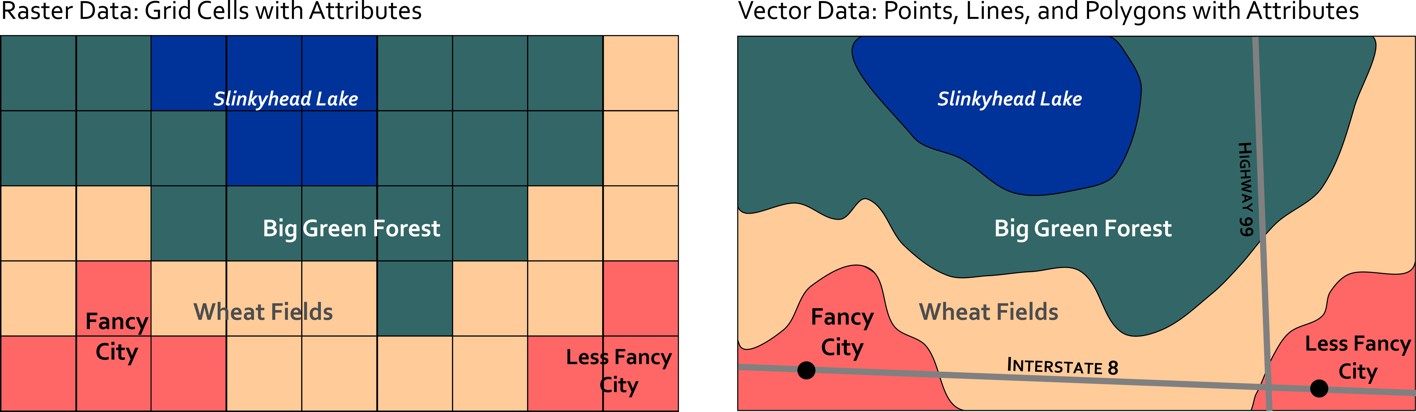
There are two main data models we use to represent spatial information in GIS. The Vector data model represents spatial features as points, lines, and/or polygons, and stores attributes about them in an associated attribute table. The Raster data model represents spatial features as a continuous grid of cells, with each cell storing one attribute.
For working with vector data, Geopandas is one of your best options. It is a spatial extension for pandas, a popular package for handling tabular datasets. For working with raster data, Rasterio is a good option. The key reason we need special packages for working with spatial data is because we need to be able to manage different spatial reference systems.