ADD A DIFFERENT BASEMAP
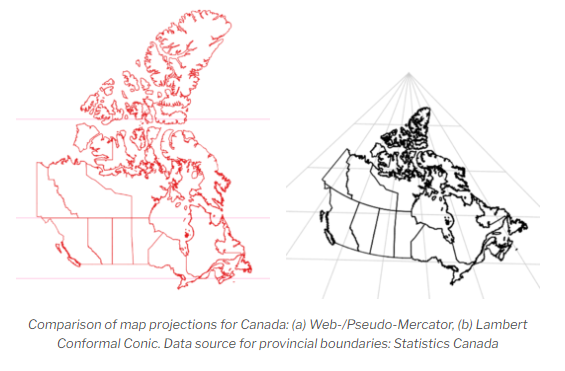
All basemaps in the basemap gallery in ArcGIS Online are in the Web Mercator projection, which distorts size the closer you get to the North Pole. Take a look at your map again and notice how disproportionately large the Northern Territories are in the Light Gray Canvas basemap.
Because we are now going to focus on Canada, let’s use something that is more appropriate for this region of the world. A far better projection for Canada is the Lambert Conformal Conic, which you can see side-by-side in the image below with the Web Mercator projection.
Let’s try and find a basemap with the Lambert Conformal Conic projection by searching ArcGIS Online, since all of the basemaps in the gallery are in Web Mercator.
To Do
From the left sidebar, click on Add and click on Browse layers.
1 Select ArcGIS Online from the dropdown and then search for Canada_Provincial_Boundaries_3347. Add this to the map as the basemap by clicking on the layer and then Use as basemap.
2 You may need to rearrange some of the layers in the map by dragging them to where you want them to be.
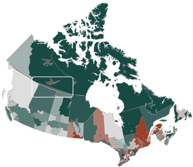
Now any data we already have in or add to the map will reproject on the fly to this Lambert Conformal Conic projection, although you may notice that the data we added did not reproject perfectly, as I’ve highlighted in the image below. ArcGIS Online still does not handle projections as well as desktop GIS software.
Be sure and save your map.
For more information about map projections, check out another Research Commons workshop Understanding Spatial Data: Map Projections.