Downloading Data
While the workshop folder you downloaded contains some prepared data for Vancouver, knowing how to search for geospatial data and download it from the web is an important skill to have. Therefore, this page will guide you through downloading different kinds of geospatial data from municipal repositories. If you haven’t already:
Example: Downloading Parks from Calgary’s Open Data Portal
Downloading geospatial data from municipal data portals isn’t always straightforward. It can be tricky to find the right buttons to press to downlaod the right file format. Remember that if there’s an interactive map vizualizing geospatial data, there is likely a way to access and download the data in a spatial format (e.g., shapefile, geodatabase, or geoJSON).
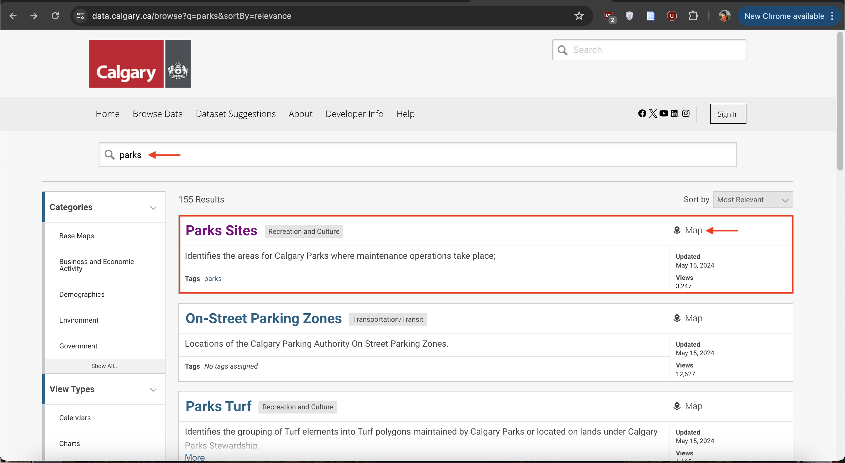
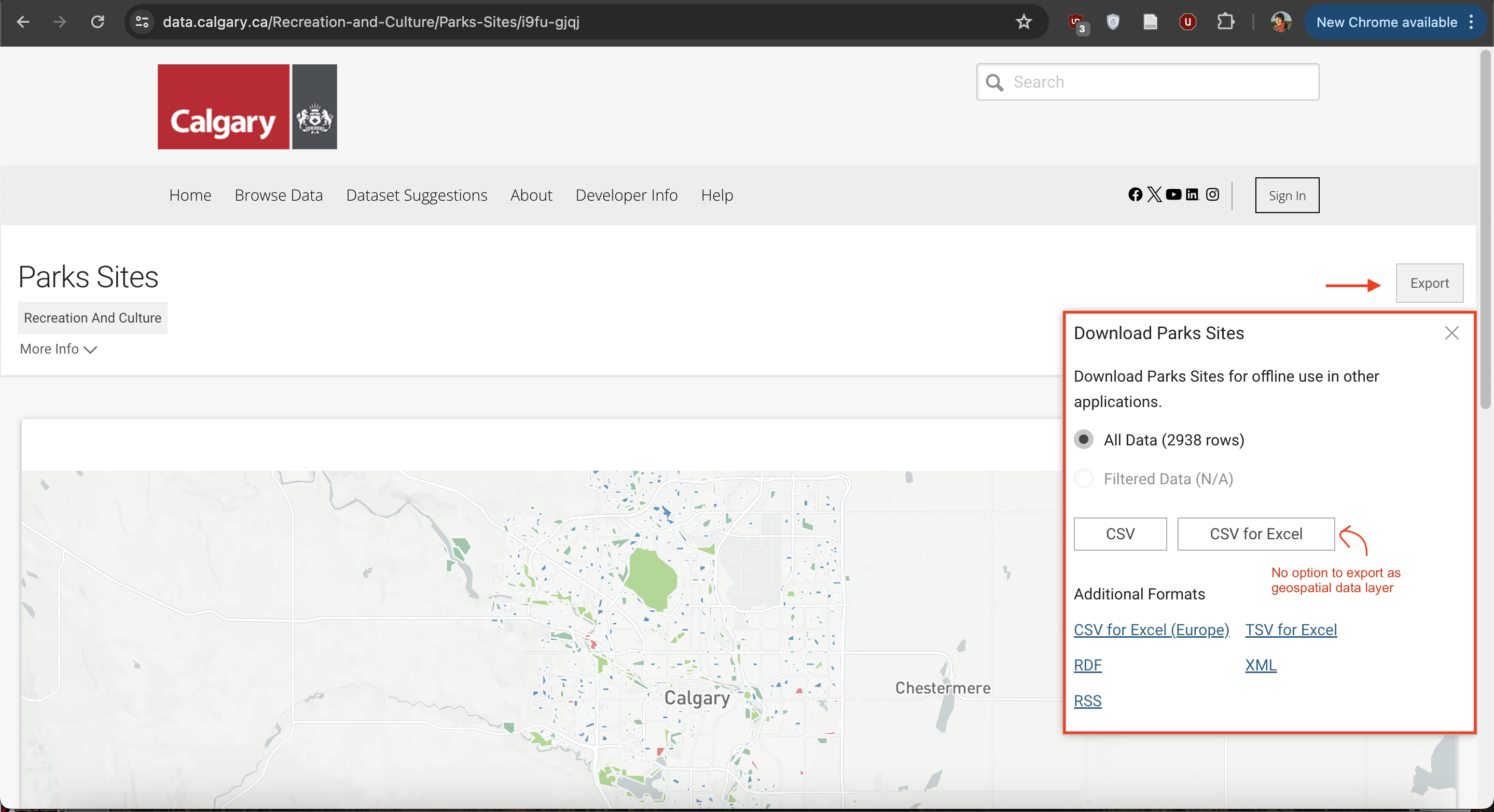
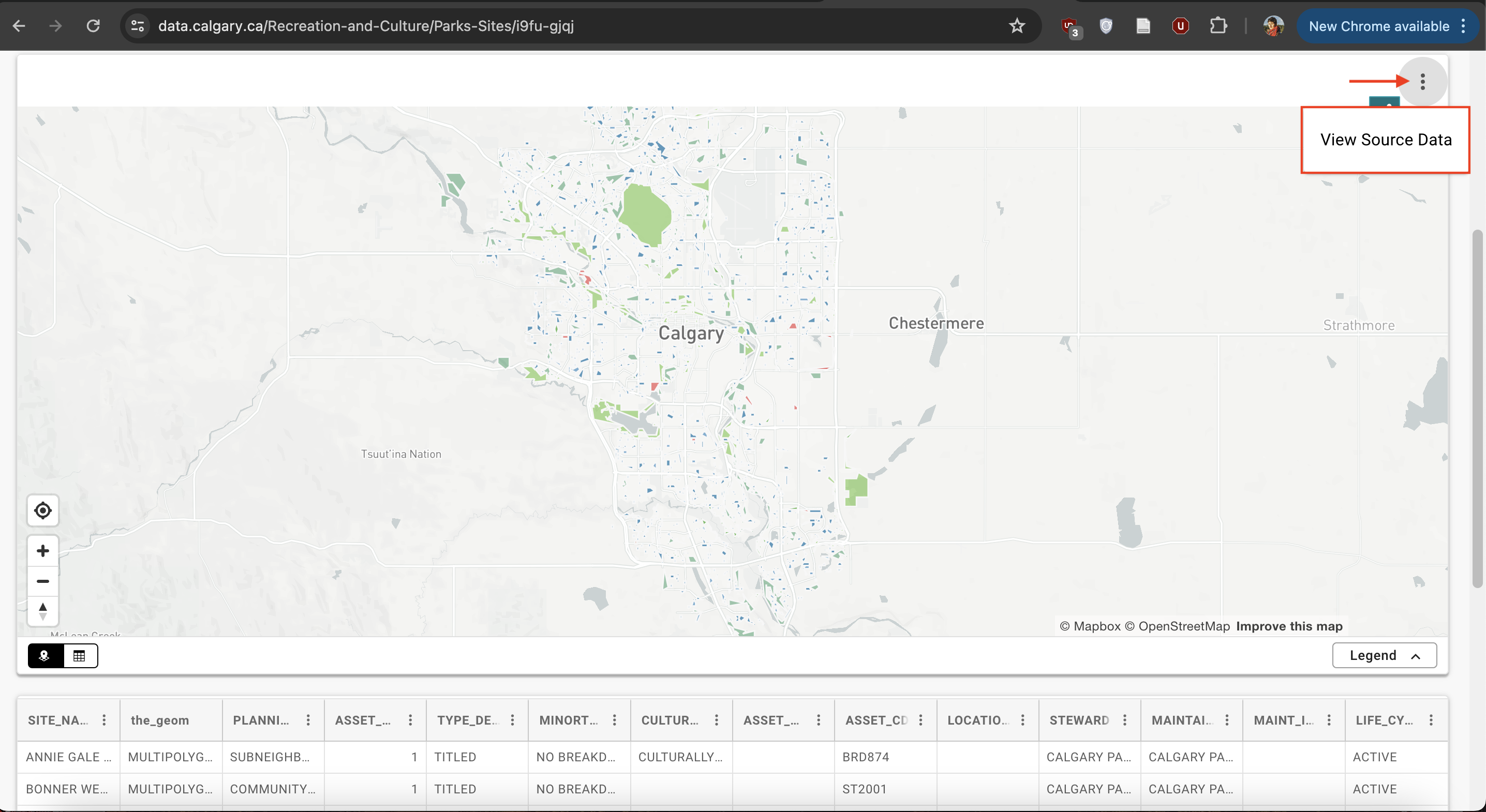
Either geoJSON or shapefile will do. 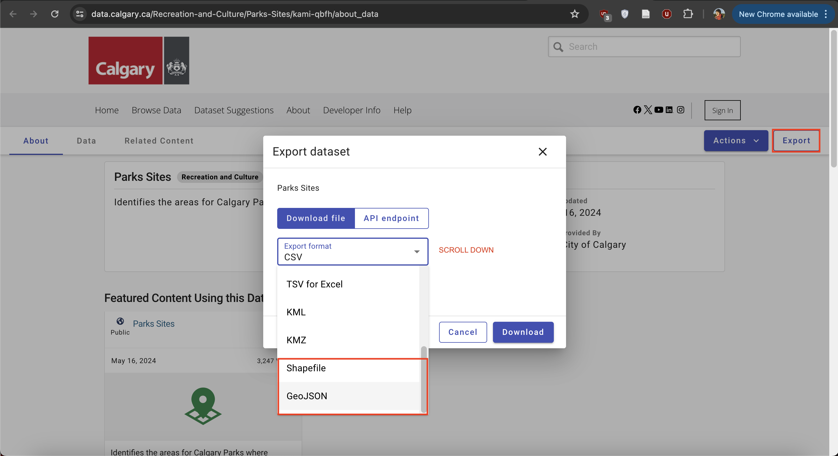
Practice
#1 Download Public Parks
Practice downloading geospatial data for public parks of the city of your choice. Note: The dataset might not be named simply ‘parks’; it could be ‘parks and open spaces’. Download the dataset in either .geoJSON or shapefile format. Make sure to Unzip the downloaded file if needed, and move it to your workshop folder.
Victoria
Toronto
Kelowna
Kamloops
Calgary
Penticton
Halifax
Edmonton
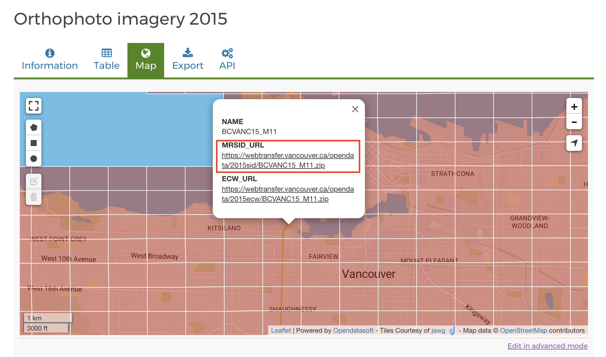
#2 Download Aerial Imagery
Use the interactivemap to download the aerial imagery for 1 grid tile of Vancouver. To do so, click the tile and download the zip folder under the field MRSID_URL. Unzip the downloaded file and move it to your workshop folder.
Before moving on, make sure all downloaded files are unzipped and moved to your workshop data folder.
Loading last updated date...