Exercise 1: What coordinate system is my data in?
1 In the project you just opened, make sure you are in the map tab WGS1984.
In ArcGIS Pro, each map is automatically loaded with a default topographic basemap, which takes on the coordinate system of the first dataset added to the map.
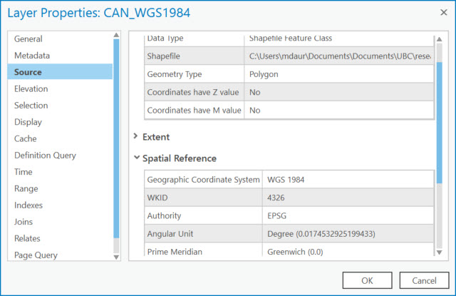
Inspecting the Metadata
Metadata is data about data. Let’s look at the metadata (i.e. properties) of the dataset to learn a bit about it.
2 Right-click the data in the Contents pane and select Properties.
3 Under the Source tab, expand the Spatial Reference section and note what is listed for Geographic Coordinate System and Angular Unit.

In the next exercise we’ll go over projection on-the-fly.