Gathering Data
In the Introduction to Mapmaking with QGIS, you learned about spatial data and how to search for the data you need. Because finding, downloading, and preparing spatial data is a major part of mapping for academic publication, you will be guided through downloading the main datasets for today’s workshop on your own.
The reference map(s) we will make today will use vector data data from Natural Earth, Statistics Canada, and Native Land Digital. The workshop folder contains some of this data, as well as additional datasets for you to practice thematic mapping. However, we still need data on:
- Canadian provincial & territorial boundaries
- World countries, lakes, and oceans
- Point over Ottawa, Canada’s capital city
Follow the instructions below to find and download this data. Remember, move each dataset you download to the workshop folder and unzip it there.
Download Data
1. Download Provincial Boundaries
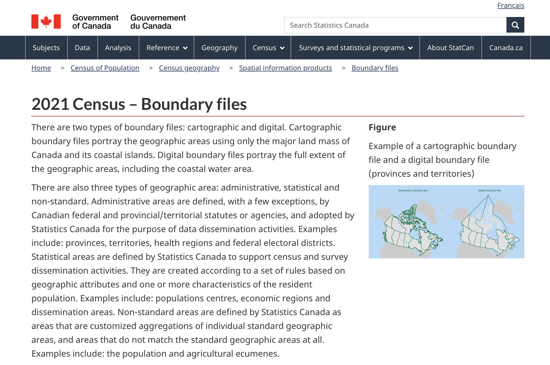
We’ll download provincial boundaries from census data hosted by the Government of Canada’s data portal. The website calls it 2021 Census – Boundary files.
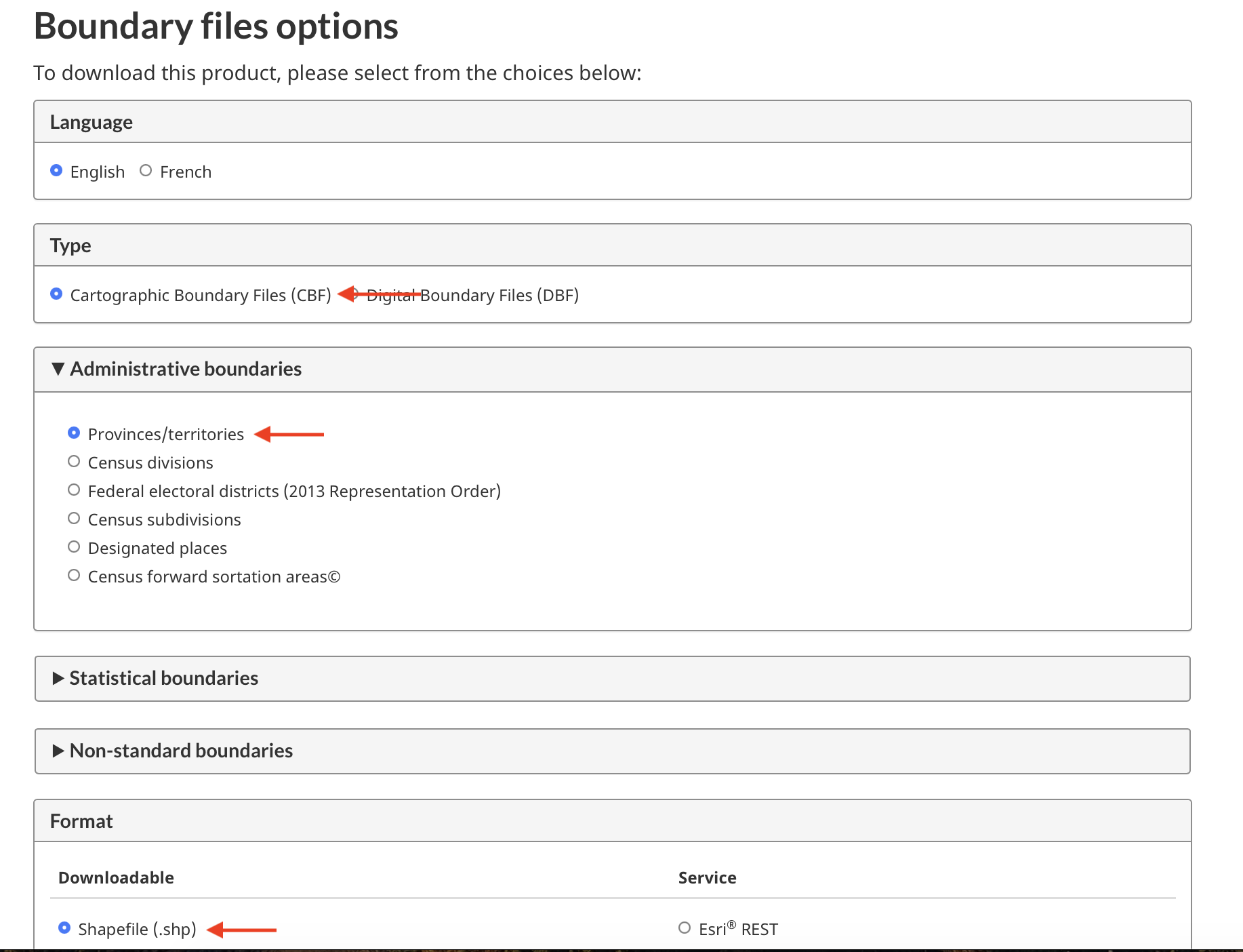
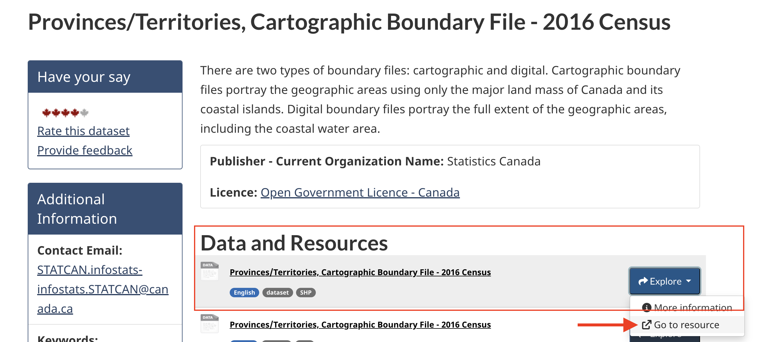
If you find this takes a long time to download, you can download the dataset from 2016instead. Download the very first one by clicking Go to resource.
2. Download Natural Earth Data
Navigate to www.naturalearthdata.com. Go to Downloads.
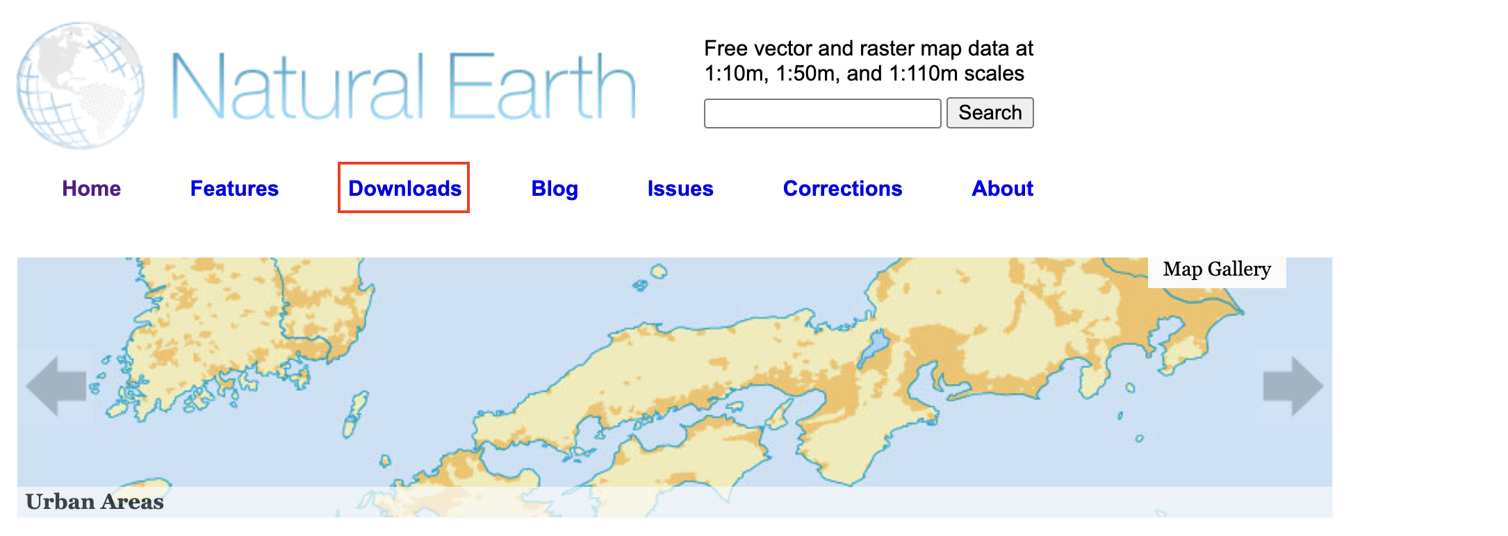
You have the option to download large scale, medium scale, and small scale data. Large scale will give you the most detail, and therefore be a heftier file. Because our Natural Earth data will be used as context for surrounding countries only, we actually prefer a less detailed, smaller scale outline. So, let’s download vector data at the medium scale. We will download 3 files: Countries, Ocean, and Lakes+Reservoirs. Countries will be under “Cultural” and Ocean and Lakes under “Physical”.
3. Create a point over Ottawa
Finally, we will create a point over Ottawa. To do this, will use geojson.io, an online platform where you can click to create simple point, line, and polygon features which can then be downloaded and uploaded to a GIS.
-
Go to geojson.io
-
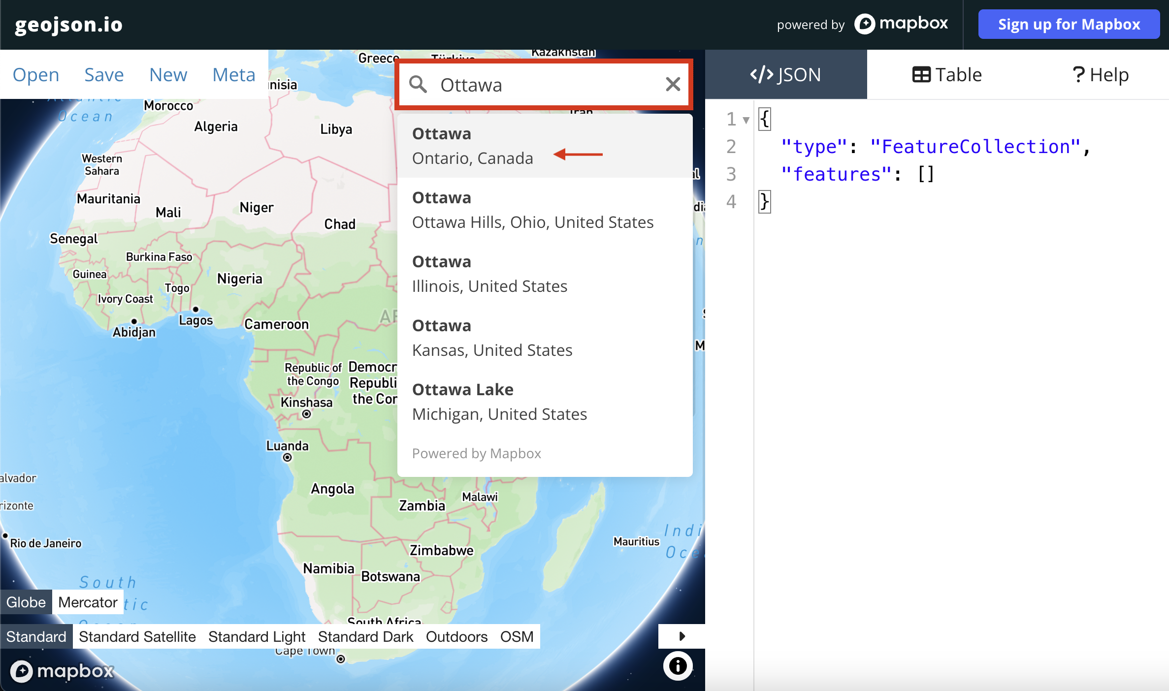
Simply type “Ottawa” in the search bar and the webmap should zoom to the desired location.
-
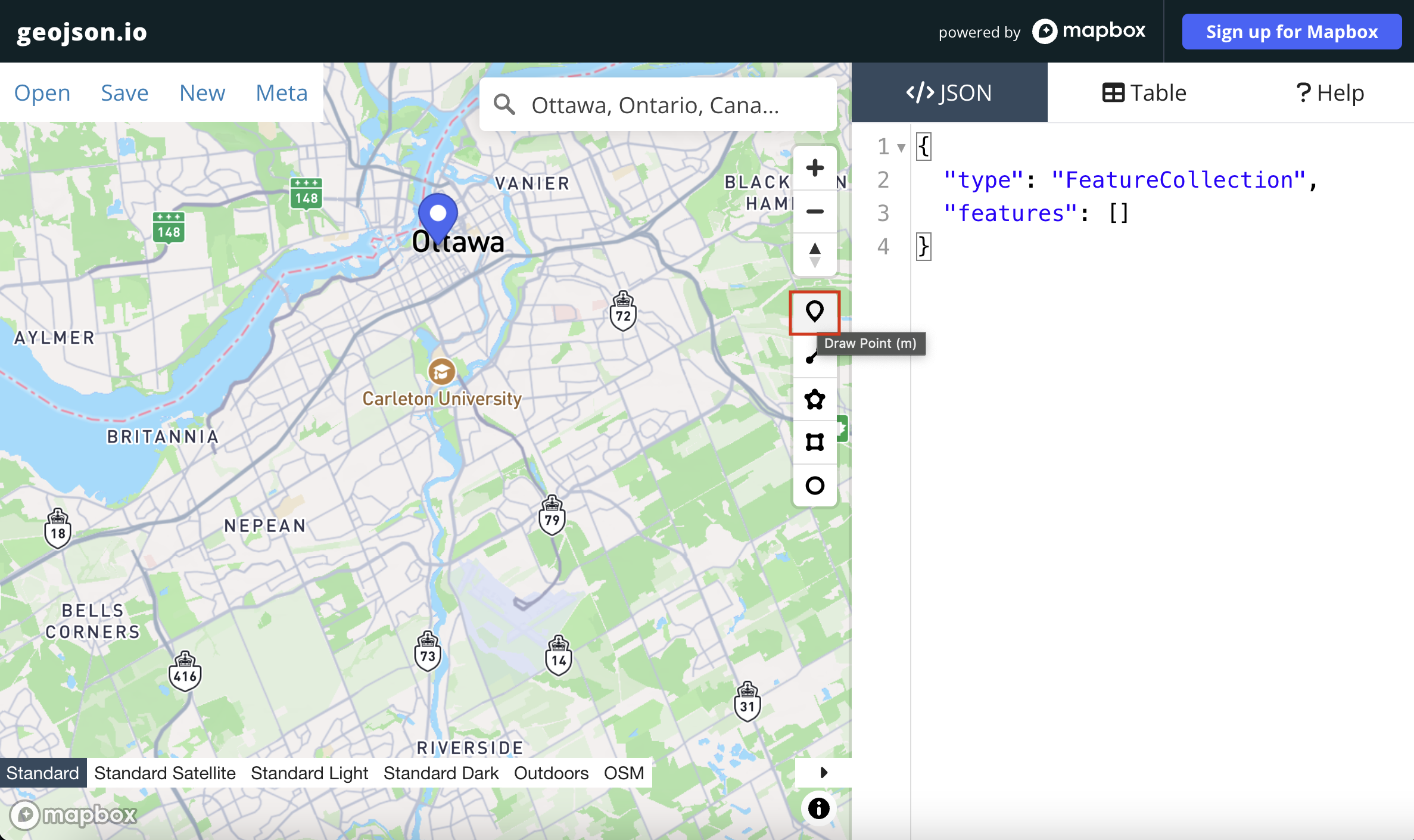
Click the drop-pin icon. Your cursor should turn into a cross hair. Now click on the map, exactly where the drop-pin for Ottawa is already given.
-
Once you click, you will notice some geoJSON code appears on the right-hand panel. This is the geoJSON that stores a single point. Click Save in the upper left-hand corner, and save your new point layer as either a
geojson(notice, however, you can save as a shapefile or another file format as well). Once the file is downloaded, ***move it to yourreference-mapping-workshopfolder. You may need to rename it toottawarather thanmap.geojsonwhich is the default.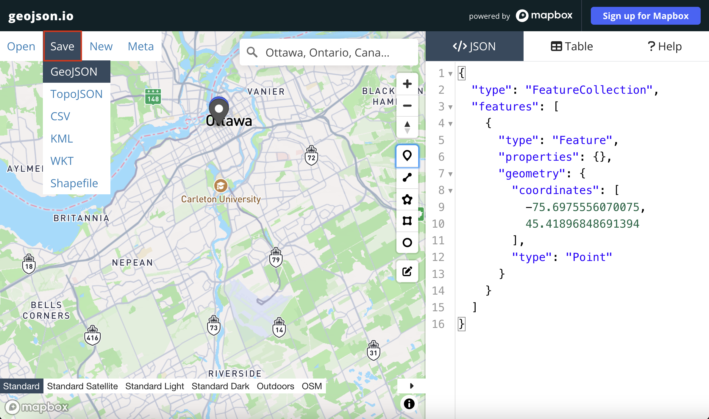
Remember to move all downloads to your workshop data folder and unzip them there.
Data Provided
Some data is provided already for you.
-
Inside the workshop data folder you’ll see a subfolder called
thematic-mapping. This contains data on chestnut street trees of Vancouver, downloaded from Vancouver’s open data portal and modified slightly to make them ready for mapping. You are welcome to use these layers to practice thematic mapping. -
Indigenous territories from Native Land Digital API. This data was downloaded for the entire Earth in
.geojsonformat. While the file is provided for you in the workshop data folder, you can practice downloading it yourself after this workshop by either signing up for your own API key, or usingAADlPNbKCBAepz816odRT(my key) and following the instructions here.
Take a moment to explore native-land.ca so that you can visualize the Indigenous territories, languages, and treaties in your area. Below is an interactive snapshot of where we are. Explore the full globe map here. On the left, you can search by territories, languages, and/or treaties. At the bottom right, you can choose to show or hide colonial boundaries, roads, and namings. You can also increase the text size and save/download your current view as an image.
Loading last updated date...