Map Production with QGIS
Please see Thematic Mapping with QGIS for the re-developed version of this workshop.
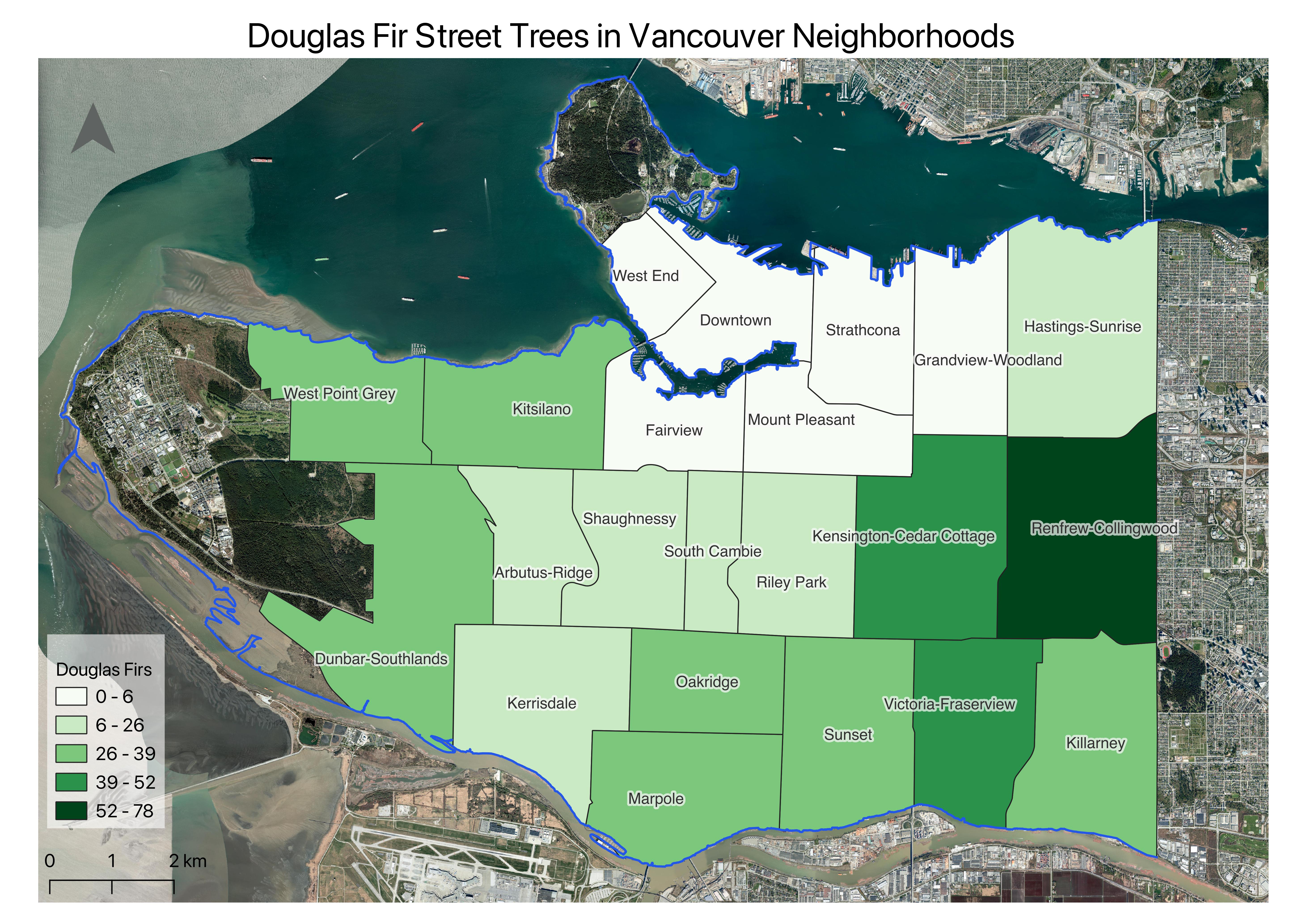
This is an introductory workshop focusing on the fundamental concepts and skills needed to begin using QGIS to explore and analyze spatial data. The result of this project will be a choropleth map showing the number of Douglas Firs lining the streets in each of Vancouver’s neighbourhoods. We will compose and export this map for print. By the end of the workshop participants will be able to:
- understand different types of geospatial data
- navigate the QGIS 3.34 LTR interface
- browse files and add data to a QGIS project
- query data from the attribute table
- create a new shapefile
- edit the symbolization of spatial data
- compose a map document for export
The final map you will create will look something like this:
Note: While the workshop will be taught using the most recent QGIS Long Term Release (LTR), image documentation for the online workshop website references QGIS 3.22.7. Because the versions are only one release apart, differences between your screen and the workshop images should be minimal if any.
Before the workshop
-
Download QGIS! QGIS can be downloaded from qgis.org’s Downloads page. In most cases, you’ll want to download and install the Long term release instead of the latest release - currently QGIS 3.40.4 ‘Bratislava’. This will give you most of the functionality you’ll need without encountering the software bugs of newly released versions. See the subpage to this page installing QGIS for further guidance.
-
Download and unzip the workshop data folder below. Download it to a folder on your physical computer, such as Desktop or Downloads, not OneDrive.
GIS Resources at UBC:
- General Informational website for all things UBC GIS: gis.ubc.ca
- UBC Library guide for finding and working with GIS resources: guides.library.ubc.ca/gis
- Archive of Research Commons workshops
- Research Commons Events Calender for upcoming facilitated workshops
- Contact UBC Library’s Geospatial team:
library.gis@ubc.ca - Schedule a 1:1 consult with the geospatial team here
The current version of this workshop was authored by Lily Demet. A previous version was authored by Elizabeth Fernandes.
Table of contents
View workshop content in GitHub
Loading last updated date...